I want to travel. I want to see the world. Go to different places and learn new things. I know most of us have the same dream but that’s quite the expensive venture. However, thanks to Google Earth, now you can live the dream right from your desktop or smartphone.
Google Earth is a computer program that renders a 3D representation of Earth-based primarily on satellite imagery. The program maps the Earth by superimposing satellite images, aerial photography, and GIS data onto a 3D globe. This allows users to see cities and landscapes from various angles.
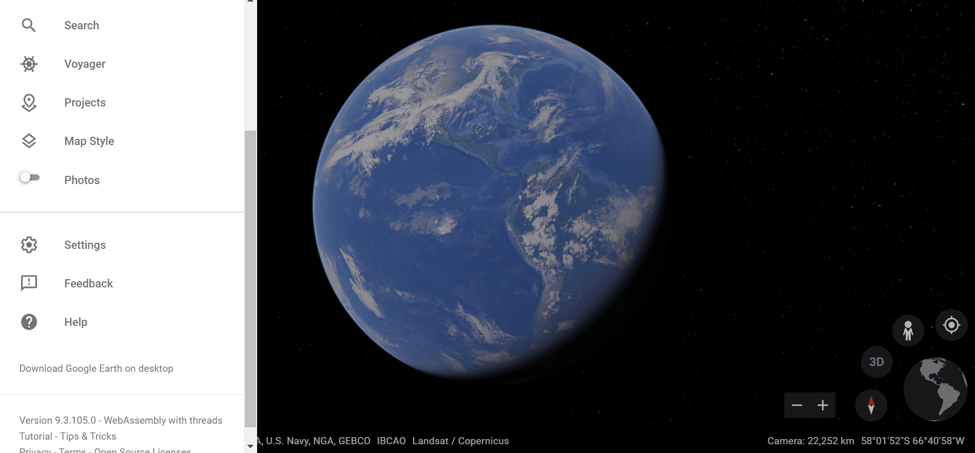
How To Use Google Earth
Users can explore the globe by entering addresses and coordinates, or by using a keyboard or mouse. The program can also be downloaded on a smartphone or tablet, using a touch screen or stylus to navigate.
Start off your week with tech news recap and trending conversations in your inbox
It is able to show various kinds of images overlaid on the surface of the earth. Google revealed that Google Earth now covers more than 98 percent of the world. It has captured 10 million miles of Street View imagery. This is a distance that could circle the globe more than 400 times.
In addition to Earth navigation, Google Earth provides a series of other tools.
Use The Search Bar and Travel
Additional globes for the Moon and Mars are available, as well as a tool for viewing the night sky.
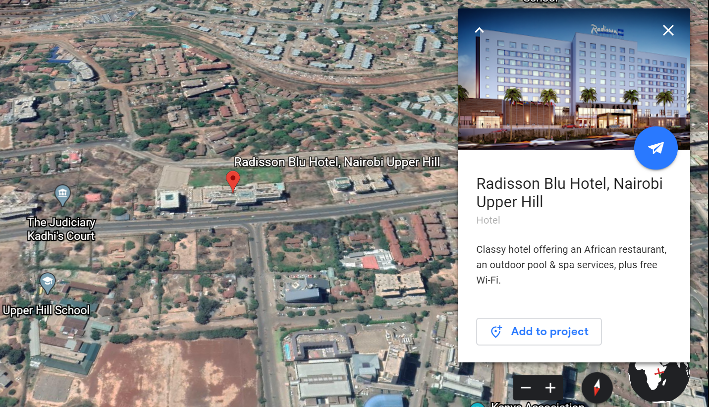
Take Advantage of Knowledge Cards
Other features allow users to view photos from various places uploaded to Panoramio, information provided by Wikipedia on some locations, and Street View imagery. The web-based version of Google Earth also includes Voyager, a feature that periodically adds in-program tours, often presented by scientists and documentarians. he knowledge cards give you a more detailed explanation of the place youare searching for.
Obit The World in 3D
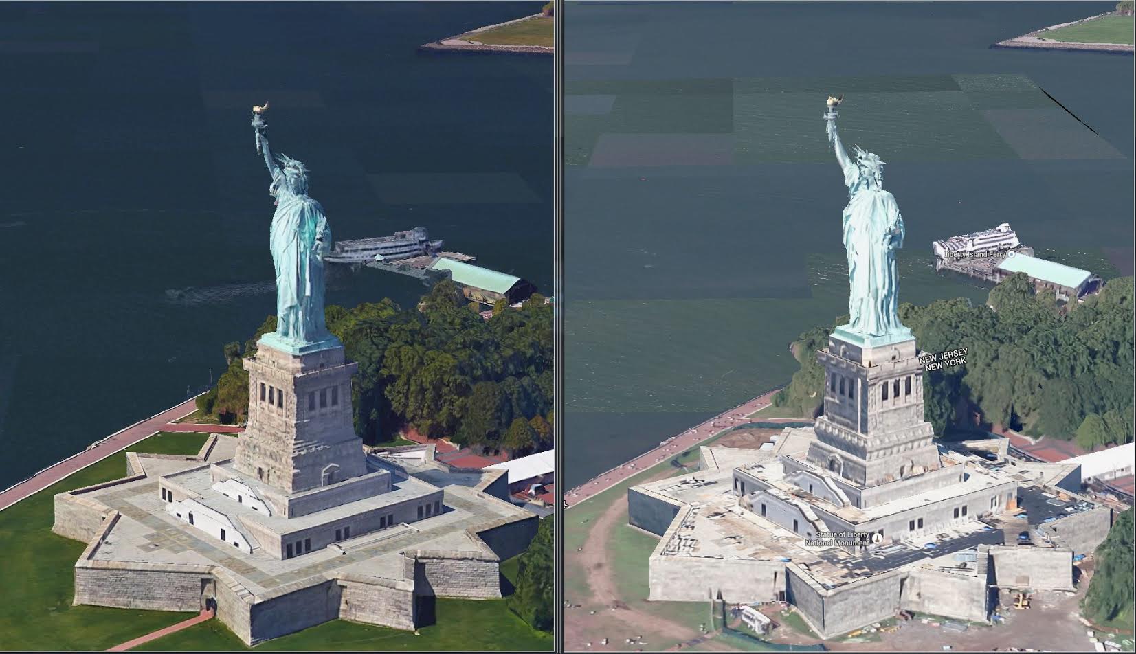
Satellites collect 2D imagery, which is laid around the globe like an orange peel. The 3D imagery, however, is gathered via aeroplane, similar to how Google Street View cars grab photos from the ground. The images are overlapped, pieced together to show depth, and covered with texture.
Is Google Earth A Privacy Threat?
I know what you’re thinking. Google Earth has been viewed by some as a threat to privacy and national security. This led to the program being banned in multiple countries. Some countries have requested that certain areas be obscured in Google’s satellite images, usually areas containing military facilities. It all depends on who uses it and how they use it. So, try and use it only for recreational or knowledge purposes. See you out there:)


Comments