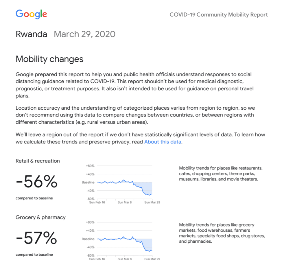
Google is using location data from smartphones to help public health officials understand how people’s movements have changed in response to the global Coronavirus pandemic. Kenyans have been under a curfew for the last week and Rwanda is on lockdown. We want to look at the comparison between the two countries to better understand the data.
Google Collects To Help Official Contain Coronavirus
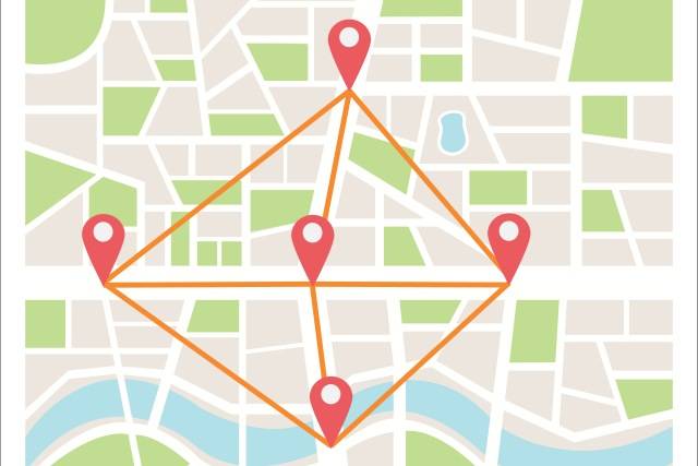

In a blog post early Friday morning, Google announced the release of its COVID-19 Community Mobility Reports. About half of the apps on Google’s Play Store and a quarter on Apple Inc’s App Store use at least one service capable of grabbing location data.
“As global communities respond to the COVID-19 pandemic, there has been an increasing emphasis on public health strategies. Including social distancing measures, curfews and lockdowns to slow the rate of transmission,” the company said in a blog post.
Using Google Maps, they collect anonymized data showing how busy certain types of places are. This helps in identify when a local business tends to be the most crowded. This same type of aggregated, anonymized data is helpful as they make critical decisions to combat COVID-19.
What Does The Report Contain?
- Retail and recreation: Visits to restaurants, cafes, shopping centres, theme parks, museums, libraries, movie theatres, and similar locations.
- Grocery and pharmacy: Supermarkets, farmers markets, food shops, and chemists.
- Parks: Public beaches, plazas, and other public spaces.
- Transit stations: Bus and train stations.
- Workplaces: Covering offices.
- Residences: Your homes.
Rwanda and Kenya Stats In Response To Coronavirus Pandemic
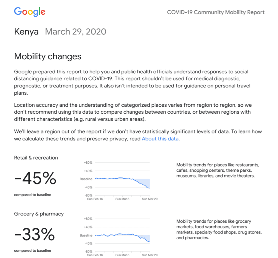

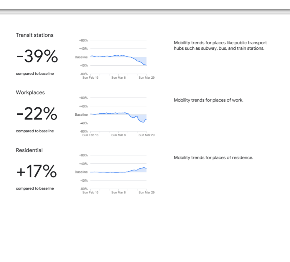

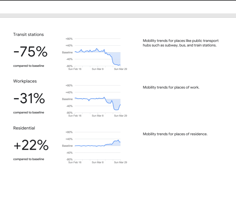
In Rwanda, we see a higher percentage of people staying home and up to a 75% decrease in people visiting transit stations.


Where Can You Get The Stats For Your Country?
Anyone can view the reports on this link, which covers 131 countries to start. In many locations, users can search for more regional data, examining reports for individual states, provinces, and counties.
After the user selects a geographic region, Google will generate a PDF with the data it has collected. Google said it chose PDFs over web pages because they could be more easily downloaded and shared with workers in the field.
/cdn.vox-cdn.com/uploads/chorus_asset/file/19868304/Blogpost_Search_Spain.gif)
/cdn.vox-cdn.com/uploads/chorus_asset/file/19868304/Blogpost_Search_Spain.gif)




Comments